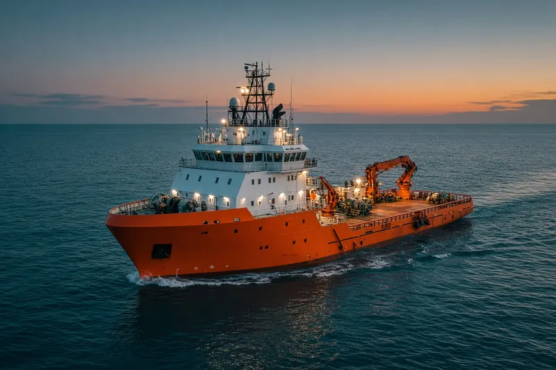
AMELIA ISLAND
IMO 9982146MMSI 368684000Call sign WDP6342
59 km SE of Port Arthur, United States
RecommendedEvery ship · Starter
€9.99/month · cancel anytime
Exact positions of all ships on the live map, plus a fleet of up to 10 ships with arrival, departure and destination alerts.
SubscribeNo account needed: pay by card and we email you a code to sign in. By paying you accept the Terms and the Privacy Policy.
The payment page could not open. Please try again in a moment.
29.3835° N, 93.6677° W
29.3835° N, 93.6677° WLast 24 h track
Voyage
- Destination
- SABINE,TX
- Speed
- 0.8 kn
- Course
- 179°
- Heading
- 177°
- Status
- Restricted manoeuvrability
- Position
- 29.3835° N, 93.6677° W
- Last report
- 22 Nov 2026, 10:37 UTC
- Nearest port
- Port Arthur59 km SE of the port
Particulars
- IMO
- 9982146
- MMSI
- 368684000
- Call sign
- WDP6342
- Flag
- 🇺🇸 United States
- Type
- DredgerAIS type 33
- Length
- 106 m
- Beam
- 21 m
- Draught
- 7.1 m
- Deadweight
- 5,333 t
Not broadcast: ETA.
About AMELIA ISLAND
AMELIA ISLAND (IMO 9982146, MMSI 368684000) is a dredger registered in the United States. It is 106 m long and 21 m wide. Its most recent AIS position, received on 22 Nov 2026 at 10:37 UTC, placed it 59 km SE of Port Arthur, United States. It was moving at 0.8 knots on a course of 179°. The crew reported SABINE,TX as the destination.
Frequently asked questions
Where is AMELIA ISLAND now?
AMELIA ISLAND was last reported 59 km SE of Port Arthur, United States on 22 Nov 2026 at 10:37 UTC. It was moving at 0.8 knots on a course of 179°.
What type of ship is AMELIA ISLAND?
AMELIA ISLAND is a dredger. It is 106 m long and 21 m wide.
What are the IMO and MMSI numbers of AMELIA ISLAND?
The MMSI of AMELIA ISLAND is 368684000. Its IMO number is 9982146. Its call sign is WDP6342.
What flag does AMELIA ISLAND fly?
AMELIA ISLAND sails under the flag of the United States (US).
Where is AMELIA ISLAND going?
AMELIA ISLAND reported its destination as SABINE,TX.
Vessels nearby
Other ships reported close to AMELIA ISLAND in the last 24 hours.
Similar special-purpose vessels
Active special-purpose vessels of a similar size (74–138 m).
More special-purpose vessels in the directory
The next special-purpose vessels with an IMO number after AMELIA ISLAND, A–Z.
- 🇺🇸AMERICAN FREEDOM 205 m 367005260 8983014 US^0F0B
- 🇫🇷AMILYBILT Dredger 228404700 9908188 OULON
- 🇬🇧AMS RETRIEVER 23 m · Anti-pollution vessel 232039261 9928982 NLSCE
- 🇨🇦AMUNDSEN 98 m · Search and rescue vessel 316050000 7510846 SCIENCE
- 🇺🇸AMY B 86 m 367727410 7216074 US^0UX0
- 🇺🇸AMY E HEBERT 28 m 367640860 7047667 MOBILE,AL
- 🇲🇭AMYNTOR 169 m · Anti-pollution vessel 538003620 9515656 AEKLF-OPL
- 🇵🇭AN DA KANG 3689 90 m · Dredger 548281800 8358635 STO TOMAS ZAMBALES

Get an alert when AMELIA ISLAND reaches SABINE,TX
Follow AMELIA ISLAND on the live map with a free account. Alerts on port calls, destination changes and AIS silence come with a fleet on any plan from €9.99/month.