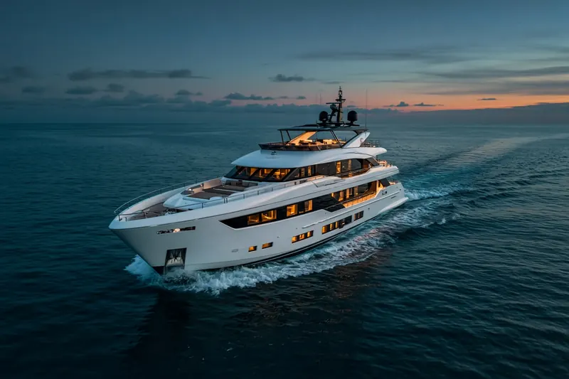
ISLAND REACH
MMSI 235025061
At sea in the Indian Ocean
RecommendedEvery ship · Starter
€9.99/month · cancel anytime
Exact positions of all ships on the live map, plus a fleet of up to 10 ships with arrival, departure and destination alerts.
SubscribeNo account needed: pay by card and we email you a code to sign in. By paying you accept the Terms and the Privacy Policy.
The payment page could not open. Please try again in a moment.
15.7274° S, 46.3101° E
15.7274° S, 46.3101° E
Voyage
- Speed
- 0.0 kn
- Position
- 15.7274° S, 46.3101° E
- Last report
- 14 Nov 2026, 05:01 UTC
Particulars
- MMSI
- 235025061
- Type
- Pleasure craftAIS type 37
- Length
- 24 m
- Beam
- 6 m
- Draught
- 3.0 m
Not broadcast: destination, call sign and IMO number.
About ISLAND REACH
ISLAND REACH (MMSI 235025061) is a pleasure craft registered in the United Kingdom. It is 24 m long and 6 m wide. Its most recent AIS position, received on 14 Nov 2026 at 05:01 UTC, placed it at sea in the Indian Ocean.
Frequently asked questions
Where is ISLAND REACH now?
ISLAND REACH was last reported at sea in the Indian Ocean on 14 Nov 2026 at 05:01 UTC.
What type of ship is ISLAND REACH?
ISLAND REACH is a pleasure craft. It is 24 m long and 6 m wide.
What is the MMSI number of ISLAND REACH?
The MMSI of ISLAND REACH is 235025061.
What flag does ISLAND REACH fly?
ISLAND REACH sails under the flag of the United Kingdom (GB).
Similar yachts & pleasure craft
Active yachts & pleasure craft of a similar size (17–31 m).
More yachts & pleasure craft in the directory
The next yachts & pleasure craft with an IMO number after ISLAND REACH, A–Z.
- 🇮🇹ISTRANKA 44 m 247101800 1005215 VIAREGGIO
- 🇰🇾ISTROS 42 m 319229500 1000423 SYDNEY
- 🇬🇷ITOTO 60 m 241708000 1000734 SEF
- 🇰🇾IVAH511 59 m 319355800 1108574 IT VIA
- 🇲🇹JAAN 41 m 229709000 8735742 ATHENS MARINA
- 🇰🇾JACIRI 40 m 319088200 1009558 BRISBANE
- 🇨🇰JACIRI 40 m 518159211 1009558 AU SHQ
- 🇰🇾JAGARE 37 m 319182500 1002081 MALLORCA

Get alerts when ISLAND REACH arrives in port
Follow ISLAND REACH on the live map with a free account. Alerts on port calls, destination changes and AIS silence come with a fleet on any plan from €9.99/month.