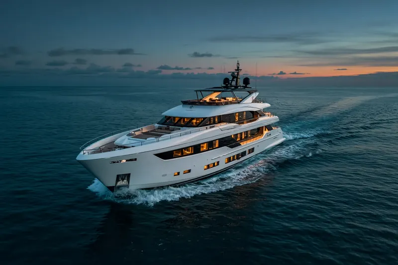
M/Y TAMASHA
IMO 1054266MMSI 339000227Call sign 6YXE7
In the port of Ambarli, Türkiye
RecommendedEvery ship · Starter
€9.99/month · cancel anytime
Exact positions of all ships on the live map, plus a fleet of up to 10 ships with arrival, departure and destination alerts.
SubscribeNo account needed: pay by card and we email you a code to sign in. By paying you accept the Terms and the Privacy Policy.
The payment page could not open. Please try again in a moment.
40.9631° N, 28.6657° E
40.9631° N, 28.6657° E
Voyage
- Destination
- ATAKOY MARINA
- Speed
- 0.0 kn
- Course
- 0°
- Status
- Underway (engine)
- Position
- 40.9631° N, 28.6657° E
- Last report
- 22 Oct 2026, 13:24 UTC
- Nearest port
- AmbarliIn port
Particulars
- IMO
- 1054266
- MMSI
- 339000227
- Call sign
- 6YXE7
- Flag
- 🇯🇲 Jamaica
- Type
- Pleasure craftAIS type 37
- Length
- 52 m
- Beam
- 10 m
- Draught
- 2.7 m
- Deadweight
- 69 t
Not broadcast: ETA.
About M/Y TAMASHA
M/Y TAMASHA (IMO 1054266, MMSI 339000227) is a pleasure craft registered in Jamaica. It is 52 m long and 10 m wide. Its most recent AIS position, received on 22 Oct 2026 at 13:24 UTC, placed it in the port of Ambarli, Türkiye. The crew reported ATAKOY MARINA as the destination.
Frequently asked questions
Where is M/Y TAMASHA now?
M/Y TAMASHA was last reported in the port of Ambarli, Türkiye on 22 Oct 2026 at 13:24 UTC.
What type of ship is M/Y TAMASHA?
M/Y TAMASHA is a pleasure craft. It is 52 m long and 10 m wide.
What are the IMO and MMSI numbers of M/Y TAMASHA?
The MMSI of M/Y TAMASHA is 339000227. Its IMO number is 1054266. Its call sign is 6YXE7.
What flag does M/Y TAMASHA fly?
M/Y TAMASHA sails under the flag of Jamaica (JM).
Where is M/Y TAMASHA going?
M/Y TAMASHA reported its destination as ATAKOY MARINA.
Vessels nearby
Other ships reported close to M/Y TAMASHA in the last 24 hours.
Similar yachts & pleasure craft
Active yachts & pleasure craft of a similar size (36–68 m).
More yachts & pleasure craft in the directory
The next yachts & pleasure craft with an IMO number after M/Y TAMASHA, A–Z.
- 🇰🇾M/Y TATOOSH 92 m 319801000 1006336 FR DKK
- 🇲🇹M/Y TENACITY 34 m 248244000 8784614 ES PMI
- 🇯🇲M3 46 m 339378000 9025285 FORT LAUDERDALE
- 🇰🇾M5 78 m 319191100 8979374 MIAMI
- 🇲🇭M55 — 538071550 9922639 LIMASSOL
- 🇺🇸M\Y ARM'S REACH 40 m 367557220 9760316 —
- 🇰🇳M\Y ESRA 34 m 341240001 8977510 KIELN
- 🇬🇧M\Y NORTH STAR 63 m 232020030 9849942 BS

Get an alert when M/Y TAMASHA reaches ATAKOY MARINA
Follow M/Y TAMASHA on the live map with a free account. Alerts on port calls, destination changes and AIS silence come with a fleet on any plan from €9.99/month.