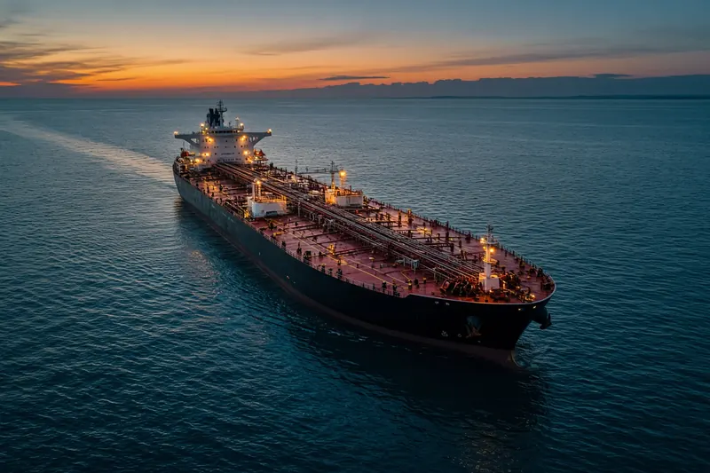
RED-SEA-1
IMO 9081071MMSI 621819089Call sign J2GT
12 km N of Djibouti, Djibouti
RecommendedEvery ship · Starter
€9.99/month · cancel anytime
Exact positions of all ships on the live map, plus a fleet of up to 10 ships with arrival, departure and destination alerts.
SubscribeNo account needed: pay by card and we email you a code to sign in. By paying you accept the Terms and the Privacy Policy.
The payment page could not open. Please try again in a moment.
11.6767° N, 43.1200° E
11.6767° N, 43.1200° ELast 24 h track
Voyage
- Speed
- 0.0 kn
- Course
- 151°
- Heading
- 321°
- Position
- 11.6767° N, 43.1200° E
- Last report
- 20 Nov 2026, 22:06 UTC
- Nearest port
- Djibouti12 km N of the port
Particulars
- IMO
- 9081071
- MMSI
- 621819089
- Call sign
- J2GT
- Flag
- 🇩🇯 Djibouti
- Type
- TankerAIS type 80
- Length
- 115 m
- Beam
- 18 m
- Deadweight
- 9,593 t
Not broadcast: destination and draught.
About RED-SEA-1
RED-SEA-1 (IMO 9081071, MMSI 621819089) is a tanker registered in Djibouti. It is 115 m long and 18 m wide. Its most recent AIS position, received on 20 Nov 2026 at 22:06 UTC, placed it 12 km N of Djibouti, Djibouti.
Frequently asked questions
Where is RED-SEA-1 now?
RED-SEA-1 was last reported 12 km N of Djibouti, Djibouti on 20 Nov 2026 at 22:06 UTC.
What type of ship is RED-SEA-1?
RED-SEA-1 is a tanker. It is 115 m long and 18 m wide.
What are the IMO and MMSI numbers of RED-SEA-1?
The MMSI of RED-SEA-1 is 621819089. Its IMO number is 9081071. Its call sign is J2GT.
What flag does RED-SEA-1 fly?
RED-SEA-1 sails under the flag of Djibouti (DJ).
Vessels nearby
Other ships reported close to RED-SEA-1 in the last 24 hours.
Similar tankers
Active tankers of a similar size (81–150 m).
More tankers in the directory
The next tankers with an IMO number after RED-SEA-1, A–Z.
- 🇱🇷REDAMANCY — 636023389 9939620 BOTANY BAY
- 🇷🇺REDUT 273 m 273125830 9408683 INPRT
- 🇲🇭REDWOOD MARINER 183 m 538009134 9902861 US LGB
- 🇺🇸REDWOOD TRADER 108 m 368224000 9809576 JP SSB
- 🇰🇲REFAN 26 — 620800647 1072036 AEHAM
- 🇸🇬REFERENCE POINT 230 m 563091800 9832808 SGPGBG
- 🇨🇲REGAL I 269 m 613447808 9247431 SUEZ
- 🇸🇬REGALITY 60 m 563097000 9671876 ASPP

Get alerts when RED-SEA-1 arrives in port
Follow RED-SEA-1 on the live map with a free account. Alerts on port calls, destination changes and AIS silence come with a fleet on any plan from €9.99/month.